
OSP as-built digitization and GIS network-record modernization
A multi-county rural ISP and utility-affiliated broadband operator across Pacific Northwest rural and small-city service territories.
- Input received
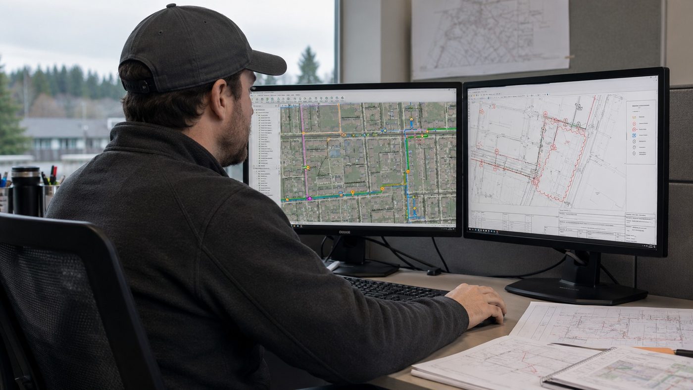
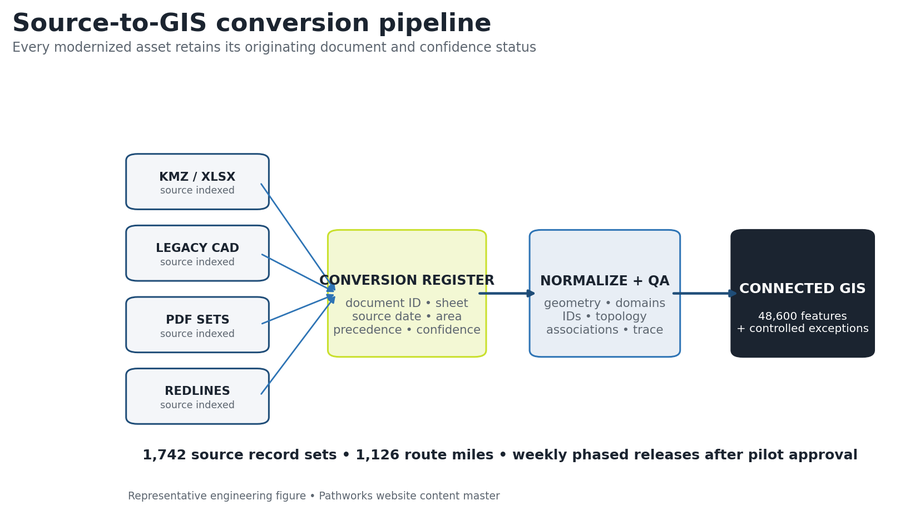
- Scanned redlines, permit/closeout PDFs, legacy CAD, shapefiles, KMZ and spreadsheet inventories, plus the client's geodatabase schema, symbology, domains, naming convention and source-priority rules.
- Delivered
- A normalized GIS database with routes, structures, equipment, cables, strands/fibers, splices and associations; updated as-built sheets and a map-book index; topology/connectivity/trace QA reports; and an error-correction and exception register.
- Timeline
- 12 calendar weeks for the representative record volume, using phased weekly releases after pilot acceptance.
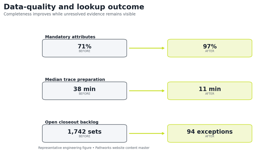
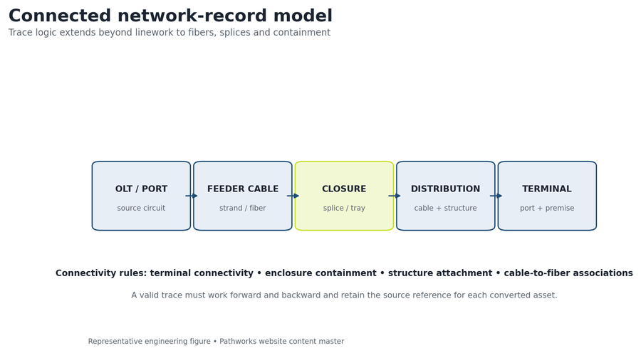
Each source document is treated as evidence and converted into a connected network model only after source precedence, schema, identifiers and relationship rules are defined. The modeled program converts 1,742 legacy record sets across 1,126 route miles, corrects 8,412 deterministic errors, and raises mandatory-attribute completeness from 71% to 97%, dropping the median trace-preparation benchmark from 38 to 11 minutes.
- Record sets
- 1,742
- Network converted
- 1,126 mi
- Errors corrected
- 8,412
- Turnaround
- 12 weeks
The engineering problem
The record estate spans scanned contractor redlines, PDF plan sets, multiple CAD standards, KMZ edits, spreadsheet splice sheets and partial GIS layers. Asset names conflict across sources, some cables terminate without an enclosure record, and legacy linework contains overshoots, gaps and duplicated structures. The goal is not merely to redraw maps: the modernized dataset must support a repeatable trace from cable to strand/fiber to splice to enclosure and route structure, while retaining source references and confidence status for items that still require field confirmation.
Design parameters and first-principles checks
| Source record sets | 1,742 redline, PDF, CAD, KMZ/GIS and spreadsheet packages |
|---|---|
| Network extent | 1,126 route miles |
| Target model | 48,600 spatial and logical features |
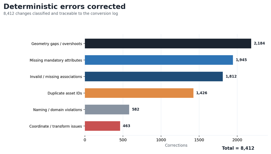
| Deterministic corrections | 8,412 geometry, attribute, identifier, association and coordinate fixes |
| Mandatory-field completeness | 71% baseline to 97% final |
| Controlled exceptions | 94 unresolved records retained with source, confidence and action owner |
| Lookup benchmark | Median trace-preparation time reduced from 38 to 11 minutes |
| Delivery | 12 calendar weeks; pilot plus weekly phased releases |
Key design decisions
Source precedence and confidence are defined before production; conflicting evidence becomes a logged exception, not an undocumented choice. Deterministic corrections are kept separate from ambiguous records: gaps, invalid domains and duplicate IDs are fixed mechanically, while uncertain ownership or concealed connections require evidence. Logical cable, fiber and splice relationships are built in addition to route geometry so the dataset supports fault and capacity workflows. A pilot area is released first, the schema is frozen after acceptance, and weekly production increments follow with repeatable QA reports.
Source inventory and conversion volume
| Source class | Record sets | Primary conversion action | Required lineage field |
|---|---|---|---|
| Contractor redline packets | 524 | Index, georeference and convert accepted field changes | Document ID + sheet/page |
| PDF plan / permit sets | 436 | Extract route, structure and annotation evidence | Issue date + plan ID |
| Legacy CAD drawings | 328 | Transform, layer-map, snap and normalize | File + layer + transform |
| KMZ / GIS packages | 214 | Reproject, domain-map and reconcile IDs | Source feature ID |
| Splice / asset spreadsheets | 240 | Normalize logical equipment, cable, fiber and splice records | Workbook + row/key |
| TOTAL | 1,742 | Controlled through one conversion register | Source, precedence and confidence |
Target feature model
| Feature class | Count | Core QA relationship |
|---|---|---|
| Route / conduit / strand geometry | 7,840 | Snapped network continuity; valid structure endpoints |
| Poles, handholes and support structures | 24,300 | Unique ID; geometry; containment/attachment association |
| Feeder and distribution cables | 6,420 | From/to structure; count; status; route association |
| Cabinets, closures and terminals | 3,120 | Containment, connectivity and equipment role |
| Fiber / splice logical records | 6,920 | Cable membership, tray/port relation and forward/reverse trace |
| TOTAL | 48,600 | Connected spatial + logical network model |
QA steps and evidence
| QA gate | Acceptance test | Evidence / result |
|---|---|---|
| Source coverage | Every agreed file has index, geography and disposition | 1,742 source rows in conversion register |
| Coordinate control | CRS and transformation recorded; residuals reviewed | Transform log and spatial spot checks |
| Geometry/topology | No unintended gaps, overlaps, dangles or duplicates | 2,184 geometry corrections logged |
| Attributes/IDs | Domains, mandatory values and uniqueness valid | 3,953 attribute/ID/domain corrections |
| Associations/trace | Containment, connectivity and cable/fiber relations valid | 1,812 association corrections + sample traces |
| Exception control | Ambiguous evidence has source, confidence and owner | 94 final exceptions; none silently discarded |
Revision record
| Revision | Trigger | Change made | Controlled outcome |
|---|---|---|---|
| R0 | Schema pilot | Mapped source fields, domains and relationships on a 40-mile pilot | Client-approved production schema and naming rules |
| R1 | Production review | Corrected transformation, identifier and association patterns across weekly releases | Deterministic corrections applied consistently |
| R2 | Trace / exception closure | Closed client redlines and reduced ambiguous backlog to 94 records | Controlled database, map book and exception register released |
Result and calculation trail
The modeled program converts 1,742 legacy record sets across 1,126 route miles, corrects 8,412 deterministic geometry, attribute and connectivity errors, and raises mandatory-attribute completeness from 71% to 97%. The remaining closeout backlog falls to 94 exception records, and a controlled lookup benchmark drops the median trace-preparation time from 38 to 11 minutes.
Correction total: 2,184 geometry + 1,945 missing attributes + 1,812 associations + 1,426 duplicate IDs + 582 domain + 463 coordinate = 8,412. Completeness gain: 97% − 71% = 26 percentage points. Trace-preparation improvement: 38 min − 11 min = 27 min, or 71% faster in the controlled benchmark.
Pathworks converted 1,742 legacy record sets covering 1,126 route miles into a connected GIS model, correcting 8,412 deterministic errors, raising mandatory-field completeness to 97 percent and reducing the controlled trace-preparation benchmark from 38 to 11 minutes.
More case studies
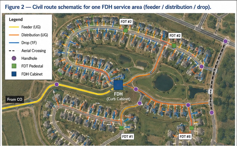

Greenfield FTTH design for 500 homes, full OSP package from plat to BOM
Built to standard US ILEC/CLEC practice: a two-stage 1:4/1:8 split localizes fault response to a single FDT instead of the whole feeder, construction runs underground-first to meet HOA aesthetic requirements, and 20–30% spare fiber is held at every tier so the network can absorb infill lots without a re-trench. The design closes with 7.4 dB of optical margin against the 28 dB GPON Class B+ budget, enough headroom for a future 1:64 upgrade at a subset of FDTs.
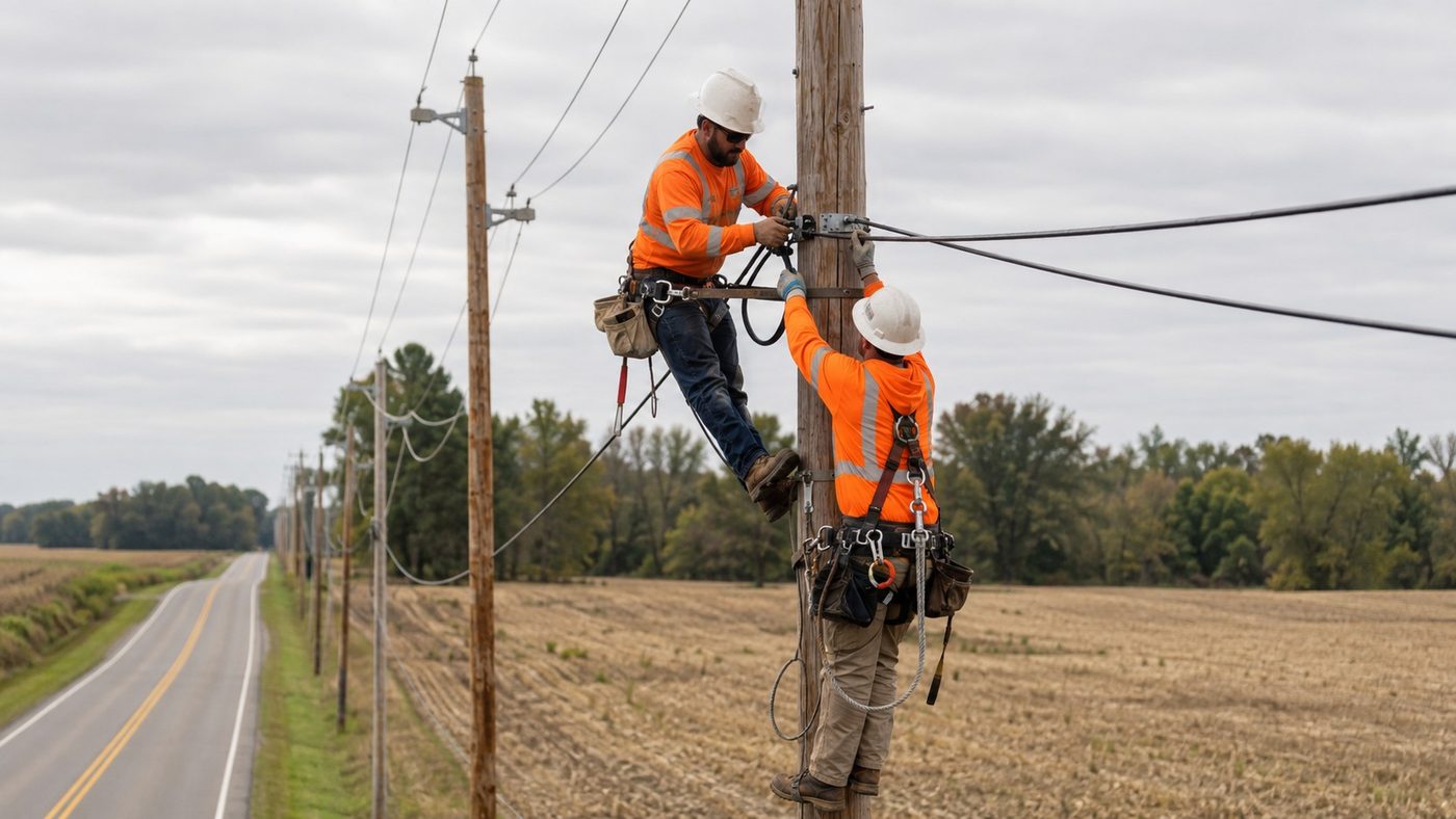
Rural greenfield FTTH design for a 500-location BEAD service area
A two-stage 1:32 split architecture assigns all 500 approved locations to complete XGS-PON paths across 512 terminal ports. Route optimization reduces the seed alignment from 35.7 to 33.0 miles, a 7.6% reduction, while the modeled planning cost falls from $9,460 to $8,940 per passing and the worst modeled path retains 4.74 dB of N2 optical margin.
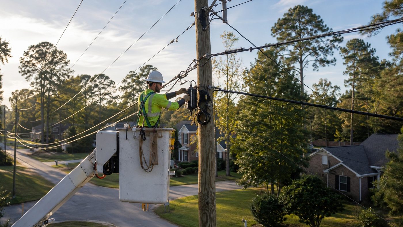
Aerial FTTH design and pole make-ready analysis
A pole-by-pole evidence record separates clean attachment candidates from conditions that require transfer, rearrangement, guying review or replacement. The modeled review identifies 226 make-ready or data conflicts across 1,946 poles; design adjustments resolve 141 before application packaging, including 15 avoided pole-replacement candidates, reaching 92% first-submission readiness.